

Carry a satellite communicator when you need routine two-way contact, tracking and an interactive SOS. Carry a PLB when you want a dedicated emergency beacon without routine messaging or a commercial service plan. Both can summon help beyond mobile coverage, but they use different satellite systems and give the user very different information after activation.
Evidence behind this guide
We carried a Garmin inReach Mini 3 Plus for three months in Quebec, spending roughly 80% of the trip outside mobile coverage. We tested routine messages, tracking and Garmin's permitted SOS test, but did not trigger a real rescue. We have not conducted a PLB field test, so PLB operation and registration details come from current UK Maritime and Coastguard Agency and NOAA SARSAT guidance. Smartphone sections use current Apple and Google support documentation.
Our recommendation
A satellite communicator is the more useful choice for most people who regularly travel beyond mobile coverage. Two-way messages confirm that help knows the situation, let rescuers ask questions and allow routine check-ins before an incident becomes an emergency. A PLB remains a strong choice for someone who wants a simple, single-purpose distress device, accepts one-way communication and will maintain its registration and battery. People operating far offshore or in particularly consequential terrain may reasonably carry both for redundancy.
The essential difference
A personal locator beacon is an emergency transmitter. When manually activated, a 406 MHz PLB sends a coded distress alert through the international Cospas-Sarsat system toward search and rescue authorities. Its registration connects the beacon's identity with owner and emergency-contact details. A GPS-equipped model can include a position in the alert, while a homing signal may help rescuers close the final distance.
A satellite communicator is a messaging service. Devices such as Garmin inReach use a commercial satellite network to exchange messages, send tracking points and start a managed SOS conversation. The communicator, service plan and response centre form one system. It has more everyday utility, but satellite features depend on an active account and a charged rechargeable battery.
The distinction is purpose rather than size. Both products can fit in a hand. The PLB is designed to transmit a distress alert when activated. The communicator is designed to maintain a flow of information before, during and after an emergency.
Satellite communicator vs PLB at a glance
| Measure | Satellite communicator | Personal locator beacon |
|---|---|---|
| Primary job | Two-way off-grid communication, tracking and interactive SOS | Transmit a dedicated distress alert to search and rescue |
| Routine messages | Yes, depending on device and service plan | No |
| SOS communication | Two-way text on services such as Garmin inReach | One-way distress transmission on conventional PLBs |
| Tracking | Normally available through a service plan | No routine public tracking |
| Network | Commercial network selected by the provider | International 406 MHz Cospas-Sarsat system |
| Ongoing cost | Active subscription or service plan normally required | No commercial messaging plan; registration is free in the UK and US |
| Battery model | Rechargeable and used during normal operation | Sealed emergency battery with an expiry or replacement date |
| Registration | Subscriber and emergency profile held by the provider | Beacon must be registered with the appropriate national authority |
| Best fit | Frequent remote travel, scheduled check-ins and changing plans | Rare-use emergency backup with minimal routine interaction |
How a satellite communicator works
A communicator calculates its position, connects to its provider's satellite network and moves messages between the device and contacts on ordinary phones, email or a supported app. The exact route varies by provider. Garmin inReach uses the Iridium network and Garmin's service platform.
Our Mini 3 Plus usually sent ordinary texts in under 30 seconds with open sky. Heavy forest extended the longest routine waits to around three to five minutes. Deep gorges could leave a message queued until the route reached a clearing. That test shows the main operational benefit and limitation: the device can keep retrying and display message status, but it still needs a usable path to a satellite.
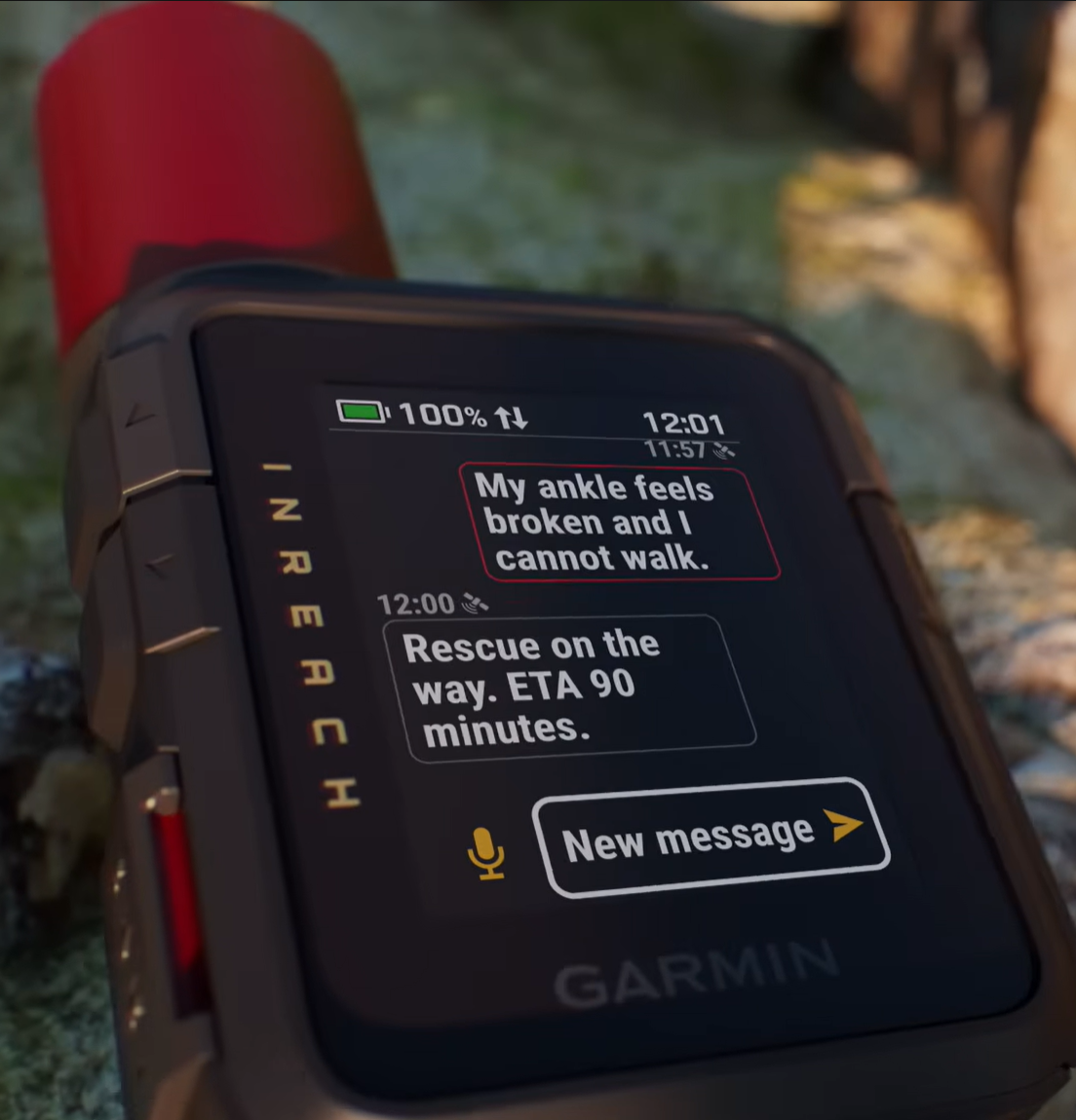
During ordinary travel, the same hardware can send check-ins, exchange custom messages and upload tracking points. During an SOS, the user can explain the injury, number of people, shelter, weather and movement. Responders can confirm receipt and provide instructions. This conversation is the communicator's strongest advantage over a conventional PLB.
How a PLB works
A conventional PLB remains dormant until the user deliberately exposes and activates its distress controls. It then transmits a digitally coded alert on the 406 MHz band. Satellites detect that transmission and relay it through ground infrastructure to the appropriate rescue authorities. The beacon's unique HEX ID connects the signal to its national registration record.
Modern GPS-equipped beacons can encode a calculated position in the distress message. Some also transmit a separate homing signal for rescue teams approaching the area. The user must deploy the antenna and position the beacon according to its instructions, normally outside with a clear view of the sky. UK guidance notes that PLBs are not required to float and must be held out of the water to transmit.
A PLB does not provide a normal conversation. The beacon continues transmitting, but the person in distress may receive no detailed acknowledgement, arrival estimate or request for more information. Some newer beacon standards support a return-link indication that the alert has entered the rescue system, but this should not be confused with two-way text messaging.
The battery is reserved for emergency use rather than daily tracking or conversation. Current UK Maritime and Coastguard Agency guidance describes typical PLB operation for 24 hours after activation; NOAA lists 24 hours as the minimum operational battery life for 406 MHz PLBs. Owners still need to follow the individual model's expiry, self-test and servicing instructions.
What happens after an SOS
With an inReach, the SOS reaches Garmin Response through the commercial satellite service. A coordinator opens a two-way conversation, gathers information and works with relevant emergency services. The device holder can describe what happened and report changes. The service requires an active plan, enough battery and satellite access.
With a PLB, the Cospas-Sarsat chain sends the coded distress alert toward the national rescue system responsible for that location. Registration data helps authorities identify the owner, contact people ashore and understand likely use. The absence of conversation means the rescue system must interpret the alert from the location, registration and any information supplied by emergency contacts.
Neither button guarantees a particular response time or outcome. Weather, terrain, local resources, jurisdiction and the accuracy of the reported position still govern what happens next. The user's job is to keep the device exposed, remain near the transmitted location when safe, preserve battery and follow any instructions received.
Registration and account readiness
A PLB must be registered to the country encoded in its beacon identity and kept up to date. In the UK, the Beacon Registry asks for the HEX ID, model, serial number, owner and emergency contacts. Registration is free. An unregistered beacon can still transmit, but missing or inaccurate records deprive rescuers of information that can speed verification and planning.
A communicator needs equivalent housekeeping inside the provider's account. The subscriber, emergency contacts and relevant medical details should match the person carrying it. Lending an inReach without changing those details can create confusion. An expired or suspended plan can remove the satellite features that justified carrying the device.
Both systems need a pre-trip check. Use only the manufacturer's self-test or provider-approved SOS test. A live PLB activation creates a real distress alert and should never be used as a casual test.
Coverage and sky view
Satellite equipment does not work through every obstruction. Dense forest, steep canyon walls, buildings, caves and a buried antenna can prevent or delay a connection. Cloud alone is usually less significant than solid terrain and poor antenna placement, though conditions differ by device and network.
A communicator can show that a message remains queued and can retry as the user moves. Our Garmin sent delayed messages after reaching better sky. A PLB repeatedly transmits its distress signal, but the holder normally has less feedback about reception. In either case, move to the clearest safe position available, deploy the antenna correctly and keep the unit oriented as its manual specifies.
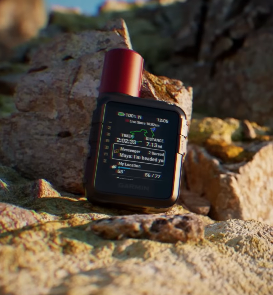
Carry position matters before the emergency as well. The Mini 3 Plus worked best high on a shoulder strap with its antenna upright. A PLB should remain protected and accessible enough that an injured user can reach and deploy it.
Battery and long-term readiness
A communicator's rechargeable battery supports all its daily functions. That creates useful information and a recurring responsibility. On our settings, the Mini 3 Plus approached two weeks with low-power messaging and 10-minute tracking. More frequent transmission, poor sky, cold, screen use and richer messages can reduce endurance. A remote itinerary still needs a charging margin.
A PLB's sealed battery is mostly untouched until a self-test or activation. This makes the beacon well suited to spending years in an emergency kit, but the apparent simplicity can hide neglect. The owner must check the expiry date, inspect the case and antenna, use only the approved self-test and arrange battery replacement through the required service route.
The communicator is easier to verify through routine use because failed charging, account or messaging becomes visible. The PLB demands deliberate maintenance precisely because it may never be used before the day it matters.
Purchase price, subscriptions and servicing
A satellite communicator combines hardware cost with a continuing service cost. We paid CA$509.99 for the Garmin Mini 3 Plus. Garmin plan prices and included allowances change, so compare the current activation, monthly or annual fee, tracking charges and message allowances in the country where the account will be used.
A conventional PLB has no commercial messaging subscription. National beacon registration is free in the UK and US. Ownership cost instead centres on the purchase, eventual battery replacement and any required servicing. A low annual cost does not make the device interchangeable with a communicator because it still lacks routine messaging and tracking.
Price should follow the task. Paying for two-way communication makes sense when family needs check-ins, a group changes plans or an incident may require discussion. Paying once for a dedicated beacon makes sense when the only required function is a last-resort distress alert.
Where smartphone satellite SOS fits
Supported phones now create a legitimate third option. Apple calls its emergency feature Emergency SOS via satellite. Google uses Satellite SOS. Both guide the user toward a satellite when mobile and Wi-Fi service are unavailable, then support a text-based emergency exchange in eligible locations.
This capability is valuable and may save a life. It does not make every phone a general satellite communicator or a PLB. Availability depends on the handset, software, country, service terms and supported emergency infrastructure. Routine satellite messages are separate from emergency SOS and vary more widely by platform and region.
A phone also serves as camera, map, torch and normal communication device, so one depleted, damaged or lost battery can remove several tools at once. A dedicated communicator provides its own battery, exposed antenna, physical SOS control and account. A PLB reserves a sealed battery for distress. Those are meaningful layers of resilience for frequent or high-consequence remote travel.
For an occasional walk in a supported region, a compatible phone's satellite SOS may be a reasonable backup to a conservative route and reliable itinerary. For multi-day travel beyond coverage, we would still carry dedicated hardware.
Choosing for common situations
Regular solo hiking beyond coverage
Choose a satellite communicator. Routine check-ins, tracking and two-way SOS help both before and during an incident. Carry it outside the pack and keep a charging reserve.
An emergency device that may sit unused for years
Choose a PLB if you accept one-way distress communication and will maintain its registration and battery. It is purpose-built for rare activation rather than everyday reassurance.
A group expedition with changing plans
Choose satellite communicators for parties that may separate. Each independent subgroup needs its own route to outside contact. A single device carried by the wrong subgroup is not a communication plan.
Offshore or especially consequential travel
Carrying both can be rational. The communicator handles routine traffic and detailed SOS information. The registered 406 MHz beacon provides an independent distress path. Maritime users should also distinguish a personal PLB from an EPIRB designed for a vessel.
Occasional trips with a supported satellite phone
Smartphone satellite SOS can form part of the plan when the model, region and service are confirmed before departure. Test the official demonstration mode and avoid assuming that a feature advertised in another country is available locally.
What we would carry
For frequent hiking, paddling or sailing beyond mobile coverage, we would choose the satellite communicator first. Our Garmin test showed the practical value of messages that normally left quickly, a track visible to people at home and a device that could explain a problem rather than emit only an alert.
We would choose a PLB for a low-interaction emergency kit, as an independent backup on a serious trip or where operating rules call for a 406 MHz beacon. We would not describe one as inferior because it lacks chat. Its narrow purpose is the reason many owners trust it.
A supported smartphone feature is useful additional resilience. We would not let it become the only remote emergency system merely because it was included with a phone already being carried.
Pre-trip emergency communication checklist
- Confirm the device, account or beacon is registered to the person carrying it.
- Update emergency contacts, medical information and trip details.
- Use the approved self-test or demonstration mode before departure.
- Check the communicator charge or PLB battery expiry date.
- Place the device where an injured person can reach it.
- Learn how to deploy the antenna and start an SOS with gloves or wet hands.
- Leave an itinerary and overdue procedure with a reliable contact.
- Carry navigation, first aid and shelter appropriate to the route.
Emergency communication shortens the information gap after something goes wrong. It does not remove the weather, terrain or travel time that determine when help can arrive.
Related field test and guide
Continue with our tested communicator
Sources and context
Technical references
PLB operation and UK registration are based on Maritime and Coastguard Agency guidance and the NOAA SARSAT description of 406 MHz beacons. Smartphone details come from Apple's Emergency SOS via satellite guidance and Google's Satellite SOS guidance. Garmin observations come from our independently purchased Mini 3 Plus and its published documentation.

Editorial disclosure: Adam bought the Garmin inReach Mini 3 Plus with his own money. Garmin had no involvement in the review or this guide. We have not field-tested a PLB for Gear Reviews.