
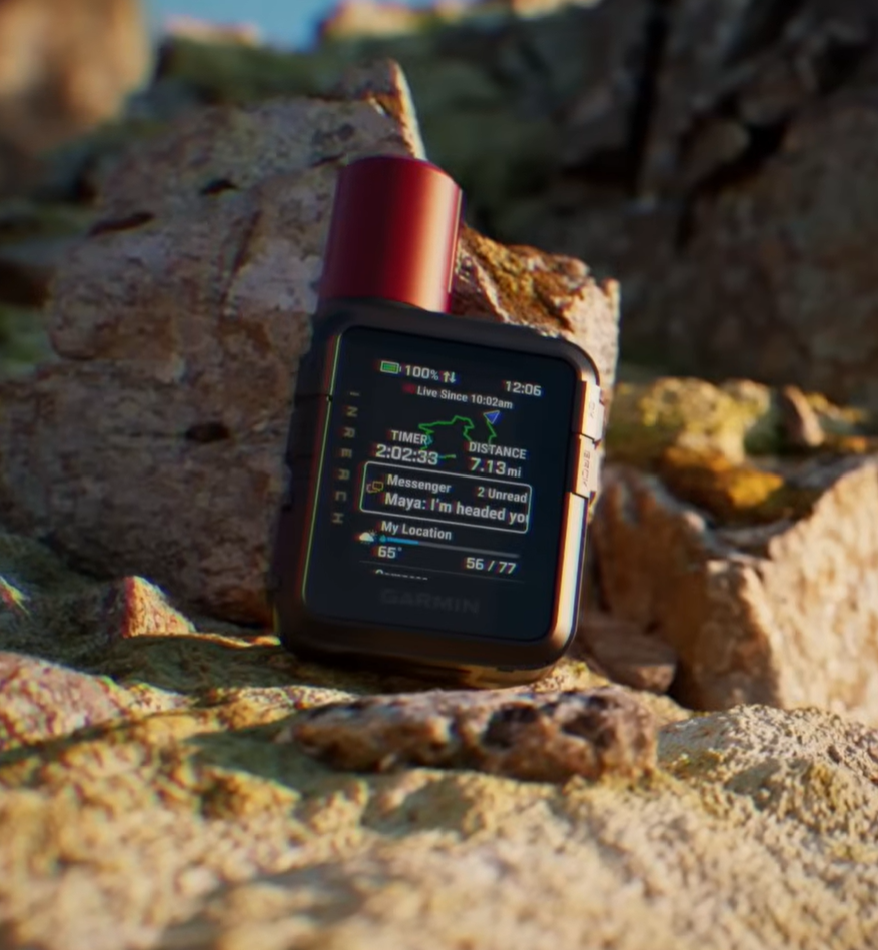
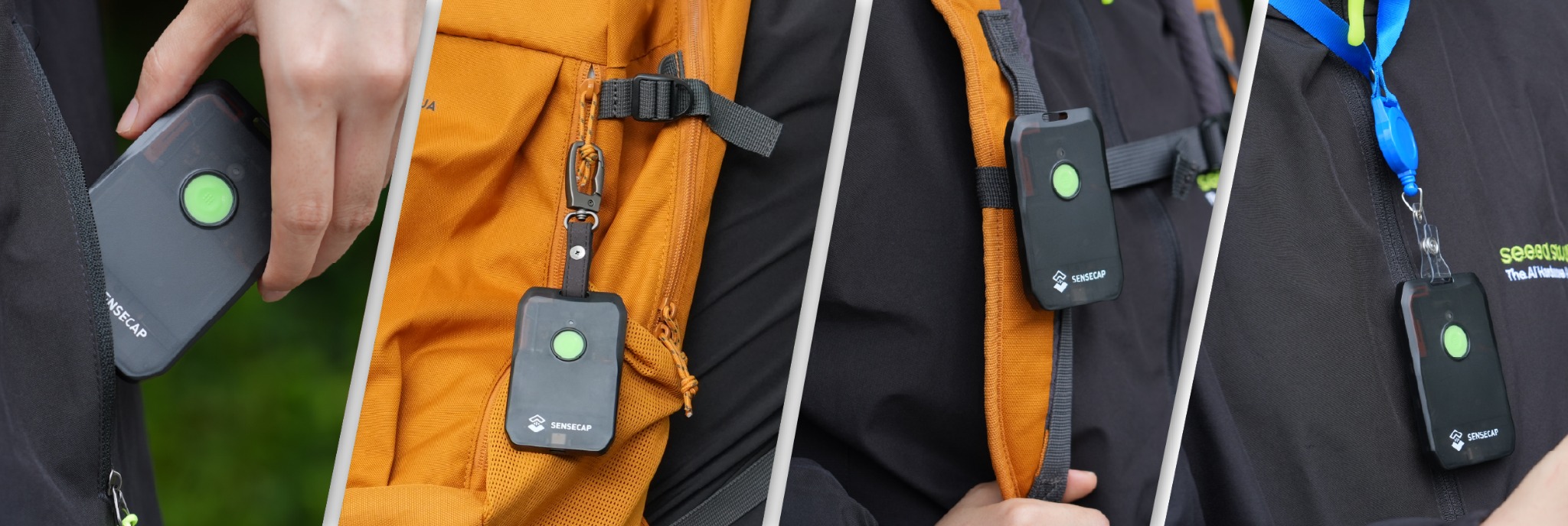
Satellite communicators and mesh radios both work beyond mobile coverage, but they solve different problems. The Garmin uses the Iridium satellite network to communicate outside the hiking group and coordinate an SOS. The X1 uses LoRa radio and Meshtastic to connect nearby equipped people without a subscription. It has no independent route to emergency services.
Evidence behind this comparison
The Garmin was carried for three months through Quebec, with about 80% of the trip outside mobile coverage. Two European 868 MHz X1 units were tested for one week in the Lake District as a direct point-to-point network. The systems were used on separate trips, so this guide compares their observed capabilities and limits rather than claiming a controlled range contest.
Our recommendation
Choose the Garmin when the device must reach somebody beyond your group or provide access to satellite SOS coordination. Choose the SenseCAP when a group already carries compatible nodes and wants inexpensive local text and position sharing. For remote group travel, the two systems can complement each other: X1 units handle routine coordination while one Garmin provides the route to home contacts and emergency services.
How satellite and mesh networks differ
A satellite communicator sends a message from the handheld to an orbiting satellite, which passes it into the provider's network. The recipient does not need matching outdoor hardware. They can receive a message through the supported app, SMS or email route, while an SOS goes to the provider's response centre. The communicator still needs a subscription, enough battery and a usable view of the sky.
A mesh tracker sends a short radio packet to another compatible node on the ground. That node can be the recipient or, in a larger network, a relay toward another node. There is no mandatory satellite-service fee, but every useful route depends on powered, correctly configured radios and terrain the signal can cross. Our SenseCAP test used only two nodes, so its 8 km best result was a direct link rather than proof of multi-hop coverage.
This network difference determines the purchase. Satellite is designed to move a message beyond the people and equipment around you. Mesh is designed to move messages among people and equipment inside the local network. A mesh can cover a useful area with enough nodes and good placement, but it does not acquire an outside connection merely because the word network appears in its description.
Satellite vs mesh communication at a glance
| Measure | Satellite communicator | Mesh tracker |
|---|---|---|
| Best for | Remote travel, outside contact and SOS coordination | Local group messaging and position sharing |
| Our score | 4.9 / 5 | 4.5 / 5 |
| Test basis | Three months in Quebec | Two units over one week in the Lake District |
| Network | Iridium satellite service | 868 MHz LoRa using Meshtastic |
| Who can receive | Contacts reached through Garmin messaging, SMS or email routes | Compatible Meshtastic nodes within a usable radio path |
| Emergency function | Dedicated SOS with Garmin Response coordination on an active plan | No independent connection to emergency services |
| Observed messaging | Usually under 30 seconds in open sky; 3-5 minutes under heavy forest | Within seconds when linked; no delivery while terrain blocks the radio path |
| Observed range | Not expressed as a local distance; requires usable sky | Up to 8 km direct in favourable terrain; commonly 1-2 km in forest and broken ground |
| Phone dependence | Short text and voice messages work on the device; photos require a paired phone | A phone is required to read and write messages |
| Measured battery | Close to two weeks with low-power messaging and 10-minute tracking | Four to five days with 15-minute position updates |
| Weight | 125.2 g | 45 g |
| Price paid | CA$509.99 plus an active satellite plan | $49 per unit plus import duty; no mandatory service fee |
Choosing between satellite and mesh
Best for remote safety
Satellite communicator
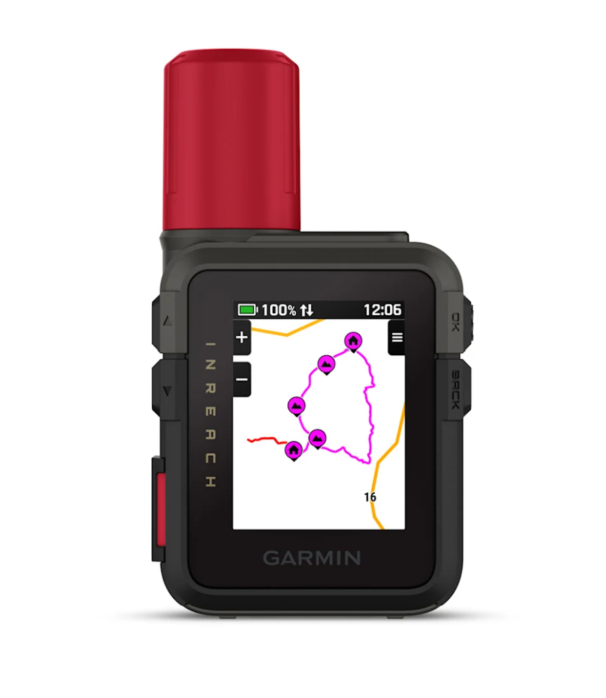
Our Garmin inReach Mini 3 Plus is the relevant choice for solo travel, remote routes and any trip where a message must leave the immediate group. Its screen, physical buttons, tracking, MapShare and dedicated SOS controls keep the essential functions available when a phone is flat, wet or missing.
Best for group coordination
Mesh tracker
Our SenseCAP MeshTracker X1 is the better-value tool for walkers, skiers, events or vehicle convoys that need to coordinate within a local area. It is small, light and inexpensive enough to issue to several people, but every useful contact depends on another compatible node and a viable radio path.
The right system for common trip scenarios
Solo travel beyond mobile coverage
Satellite is the stronger fit. A solo walker, paddler or sailor needs a route to somebody outside the trip, not a radio that waits for another local node. The Garmin also continues to provide check-ins, tracking and SOS controls if the paired phone fails. A mesh tracker can add local information where a public network happens to exist, but it should not be the sole communication plan.
A walking group that may spread out
Mesh is useful when every subgroup carries a node. Short messages and position broadcasts can answer routine questions about a junction, lunch stop or delayed walker without consuming a satellite allowance. Terrain can still split the mesh. The group needs agreed check-in times, an acknowledgement convention and a plan for what happens after contact is lost.
Family or colleagues following from home
Satellite tracking is the relevant system because the viewers are outside the local radio network. During the Garmin test, MapShare gave people at home a private link to the recorded progress. A pair of X1 trackers could show positions to each other in the field, but neither could independently publish those positions to a distant contact.
A campsite, festival or vehicle convoy
Mesh offers the better value when communication stays inside a defined area and several people need hardware. The X1 is light enough to issue across a group, sends alerts through vibration and a buzzer, and avoids a monthly service fee. Coverage should be tested in the actual terrain before the radios become part of an operating plan.
A remote expedition with several participants
The strongest setup uses both. Mesh handles frequent local coordination. One or more satellite communicators remain with people who may separate and provide outside contact, tracking and SOS access. This arrangement also prevents a single device carried by the wrong subgroup from becoming the expedition's only route out.
SOS and reaching the outside world
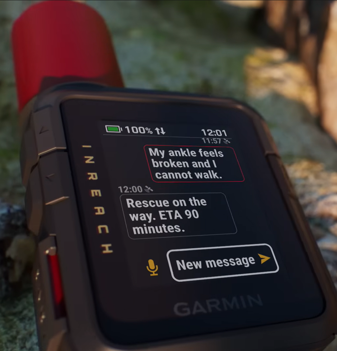
This is the decisive difference. The Garmin can send messages through satellites when mobile coverage is absent. Its protected SOS button starts a two-way conversation with Garmin Response, provided the device has an active plan, sufficient charge and a usable view of the sky. Our scheduled test received a prompt reply. We did not trigger a real emergency response.
The X1 has no equivalent service. Two units can help separated walkers exchange positions and messages, but neither creates a path to emergency services on its own. A wider community mesh might relay traffic farther, yet that infrastructure remains opportunistic. It cannot be treated as guaranteed rescue coverage.
Coverage, terrain and delivery
The Garmin needs sky rather than nearby network infrastructure. In open conditions, routine texts usually left in under 30 seconds. Heavy forest extended ordinary waits to around three to five minutes, while deep gorges could hold a message in the queue until the route reached a clearing. Caves, buildings and very narrow valleys can prevent a useful link.
The X1 needs a viable radio path to another Meshtastic node. The strongest direct result was 8 km from a ridge to the valley floor. Forest and broken ground more commonly reduced useful range to 1 to 2 km. A few hundred feet of elevation sometimes restored a link that did not exist in the valley bottom. Messages queued outside coverage appeared after the units re-entered range.
Neither radio ignores terrain. The Garmin is stronger when the recipient is far away because satellites provide the network. The X1 can be faster for people already inside the local mesh, but a mountain between two nodes can stop communication completely.
Messaging and phone dependence
The Garmin can compose short text replies on its 1.9-inch colour touchscreen, send check-ins and record voice notes without a phone. Physical buttons preserve access in heavy rain or gloves. Garmin Messenger remains better for long conversations and is required to send photos, while Garmin Explore handles routes and offline maps.
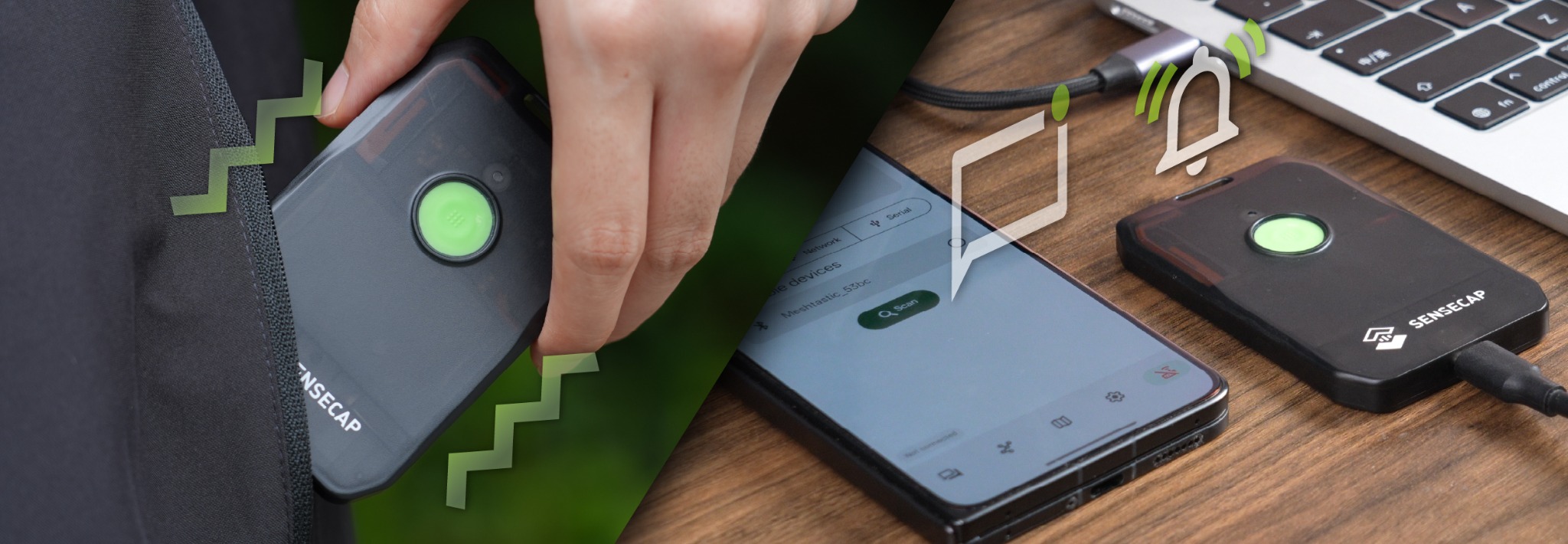
The X1 has one button, a status light, vibration and a buzzer. Those alerts are effective, but reading or writing a message requires the Meshtastic app on a paired phone. Setup took less than five minutes and Bluetooth remained stable in the test. The simpler hardware works well when every group member already expects to use a phone.
Garmin provides the more self-contained system. The X1 provides the cleaner local group conversation, private channels and position sharing at much lower hardware cost.
Position sharing and navigation
The Garmin recorded 10-minute tracking points and shared progress through MapShare, giving people at home a private link to the route. Multi-band GNSS kept the local track close to the path, though transmission of a point could wait in deep terrain. Its onboard map, waypoints, courses and TracBack are useful backups rather than a replacement for detailed mapping.
The X1's dual-band L1 and L5 receiver produced clean tracks under tree cover. Warm starts took seconds and cold starts usually took one to two minutes. Position broadcasts every 15 minutes balanced group awareness with battery life and radio traffic. Privacy settings require attention because location sharing is controlled through Meshtastic channels.
Battery and charging
The Garmin ran for close to two weeks with low-power messaging, 10-minute tracking and a short screen timeout. That result depends heavily on settings. Garmin publishes much shorter endurance for performance messaging and detailed activity recording, while poor sky view, cold and frequent screen use add further load.
The X1 lasted four to five days with Bluetooth connected and 15-minute GNSS broadcasts. Cold mornings shortened the projection, and one-minute updates consumed power faster. Both devices recharged over USB-C in about two hours and continued working from a power bank.
The Garmin wins measured endurance in the tested configurations. The X1's 45 g weight makes carrying a small shared power bank easy, but a multi-day group still needs a charging plan for both trackers and phones.
Carry and weather resistance
The Garmin weighs 125.2 g and carries upright on a shoulder strap with its antenna exposed. It survived thunderstorms and a brief creek drop during the three-month test. Its IP67 rating covers incidental immersion, while the physical buttons remain usable when rain makes the touchscreen imprecise.
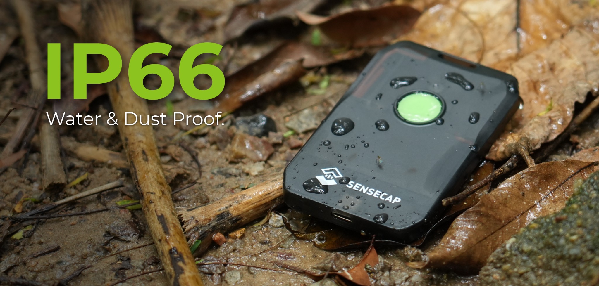
The 45 g X1 is flatter and easier to forget on a strap or in a pocket. Sustained rain, mud and a four-foot fall onto rock caused only cosmetic wear. Its IP66 enclosure protects against weather rather than immersion. The charging-port tether is the part most likely to show long-term wear, although one week cannot establish multi-year durability.
Failure modes to plan around
Satellite messages can stall under heavy forest, beside high rock walls, indoors or in caves. The Garmin queued messages until the route reached a better patch of sky, but that delay still matters when the sender expects an immediate reply. An inactive plan, outdated emergency profile, hidden antenna or empty battery creates a different failure that changing position cannot fix.
Mesh links fail when terrain, buildings, wet vegetation or the user's body blocks the radio path. They also fail when the required node is switched off, on the wrong channel or too far away. The X1 needed a paired phone for message composition, so phone power and Bluetooth became part of the system even when the LoRa radio itself remained charged.
Both systems need visible delivery discipline. Garmin shows whether a message remains queued or has sent. Meshtastic provides acknowledgements, although our app occasionally displayed a message as pending after delivery. A group should decide what counts as confirmed contact, how long to wait, where to regain elevation or open sky, and when to move from routine messaging to the emergency plan.
Cost and value
The Garmin cost CA$509.99 and requires an active satellite plan for messaging, tracking and SOS. The continuing fee is part of the safety system: it buys access to a satellite network and coordinated outside contact. Plan structures change, so the relevant comparison is the ongoing subscription rather than one fixed monthly figure.
Each X1 cost $49 plus import duty and uses open Meshtastic software without a mandatory service fee. A functioning group needs at least two nodes, and each user normally needs a phone. Even then, the hardware cost remains dramatically lower than satellite communication.
The X1 is exceptional value when local coordination is the actual job. It becomes poor value if somebody buys it expecting the safety function of an inReach. The Garmin is expensive for chatting with companions a kilometre away and much better justified when the message must travel beyond the group.
Using satellite and mesh together
The two systems overlap at messaging and position sharing, but their networks make them complementary. Mesh can carry frequent low-stakes traffic inside the group: pace changes, route choices, pickup points and campsite updates. Satellite can carry scheduled check-ins, MapShare tracking and messages to people beyond the trip.
A practical group setup gives a mesh node to each person or subgroup and places a satellite communicator with every party that may travel independently. The satellite units stay exposed high on a shoulder strap. The mesh nodes also benefit from height and separation from the body. Phones, communicators and trackers share a charging plan rather than being treated as isolated gadgets.
Neither radio replaces route planning, navigation, first aid, realistic turnaround decisions or a written itinerary left with somebody reliable. Communication improves the response to a problem. It does not remove the terrain, weather or time required for assistance to arrive.
Our verdict
Satellite for outside contact and SOS. Mesh for affordable local coordination.
The Garmin inReach Mini 3 Plus is the device to carry when communication must reach home contacts or emergency services beyond the local area. The SenseCAP MeshTracker X1 is the stronger value for an equipped group that wants quick text and position sharing without mobile coverage. On serious remote group trips, carrying both is more useful than pretending either system covers the other's job.
Read the field tests
Full reviews behind this guide

Editorial disclosure: Adam bought the Garmin and both SenseCAP trackers with his own money. Garmin and Seeed Studio had no involvement in the reviews or this comparison.