
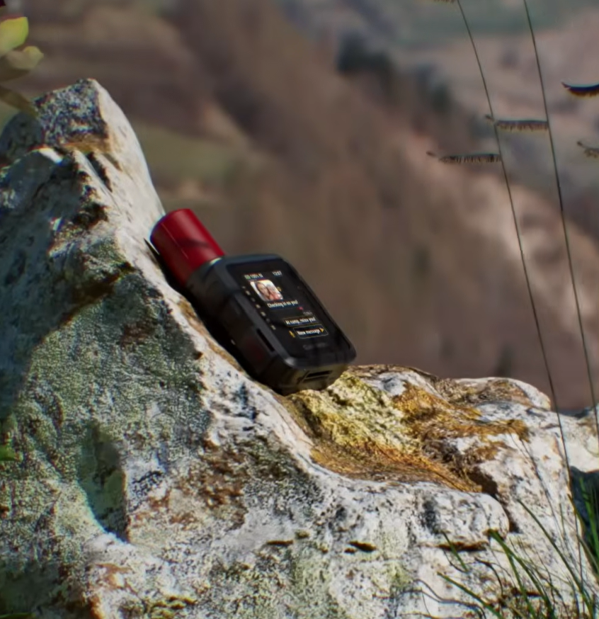
I carried the SPOT X for about 120 days of hiking, biking, camping and canoeing around Quebec. On a separate three-month trip through the province, I used the Garmin inReach Mini 3 Plus. For the wooded valleys and remote camps where I most wanted to keep in touch, I would choose the Garmin. My everyday texts sent more consistently, and its controls were much easier to use. I liked the SPOT X's standalone keyboard, long battery life with light check-ins and tough case, but its delayed messages sometimes worried my partner at home.
How I tested them
I bought both devices myself and used them on separate trips, rather than carrying them side by side through the same terrain. Conditions, antenna placement and tracking settings varied, so the message times below are observations from my trips, not a controlled network test. I used Garmin's permitted SOS test and received a reply. I never activated SPOT's SOS.
My pick
Take the Garmin if reliable everyday contact from wooded country is the priority. Its routine texts reached home faster during my trips, it is easier to use in gloves and its smaller body is nicer to carry. The SPOT X makes more sense if you mostly travel under open sky, want a physical keyboard and can live with slow or failed messages under cover. Both devices still need a view of the sky, so a deep gorge can cause trouble for either one.
Garmin inReach Mini 3 Plus vs SPOT X at a glance
| In my use | Garmin inReach Mini 3 Plus | SPOT X |
|---|---|---|
| My review score | 4.9 / 5 | 3.2 / 5 |
| Network | Iridium | Globalstar |
| Time carried | Three months across Quebec | About 120 days across Quebec, on a separate trip |
| Ordinary texts with open sky | Usually under 30 seconds | Usually a few minutes |
| Ordinary texts in difficult cover | Longest routine waits around 3 to 5 minutes in heavy forest; a deep gorge could hold messages until I moved | Sometimes around 40 minutes or failed under dense canopy; some deliveries reached home hours late |
| Input on the device | Small colour touchscreen and physical side buttons | Small physical QWERTY keyboard and directional pad |
| Battery experience | Close to two weeks at 10-minute tracking with a 30-second screen timeout | Weeks with tracking off and a few daily check-ins; long weekends with tracking on |
| Charging and weight | USB-C; 125.2 g published weight | Micro-USB; 198.4 g published weight |
| SOS experience | Permitted test received a response; no real emergency | Never activated or tested |
| Price I paid | CA$509.99 for the unit | €274.00 on offer, with the €29.95 activation fee waived |
Which one suits your trips?
My choice for wooded routes
Garmin inReach Mini 3 Plus
I would choose the Garmin for hiking, paddling or camping where I expect long stretches beneath trees or in steep valleys. It still needs sky and it did queue messages in a gorge, but my everyday messages arrived much more predictably. I can send a short note on the device without digging out my phone, and the physical buttons are a welcome fallback when rain or gloves make the touchscreen awkward.
An option for open-country travel
SPOT X
The SPOT X worked far better for me on open bike rides than in closed-in forest. Its standalone keyboard means you can compose a full message without pairing a phone, and its preset check-ins are quick to use. If those are the jobs you mainly need it for, there is a case for it. I would be much less comfortable relying on it for time-sensitive reassurance from a wooded valley.
Messages and the wait at the other end
In open country, both devices did the basic job. With the Garmin I usually saw an ordinary text go out in under half a minute. On the bike with a clear sky, SPOT messages generally went through in a few minutes. That difference is noticeable, but a few minutes would be entirely acceptable for a casual “made it to camp” message.
The harder moments were under cover. Hiking through heavy forest with the Garmin, my longest routine waits were around three to five minutes. A deep gorge could stop a message until I got back to a better opening. With the SPOT X, dense canopy and wooded Quebec valleys produced waits of around 40 minutes, outright failures, and a few messages that reached home hours later. That worried my partner on a couple of occasions, which is basically the opposite of why I was carrying it.
I did not carry both units through the same valleys at the same time, so I cannot put the whole difference down to Iridium versus Globalstar. Weather, tree cover and antenna placement also affect delivery. Both manufacturers say the devices need a clear view of the sky. The difference on my trips was still big enough to change which one I would pack. I want the person at home to know I have checked in, rather than wonder whether the message has sent at all.
Typing, gloves and phone apps
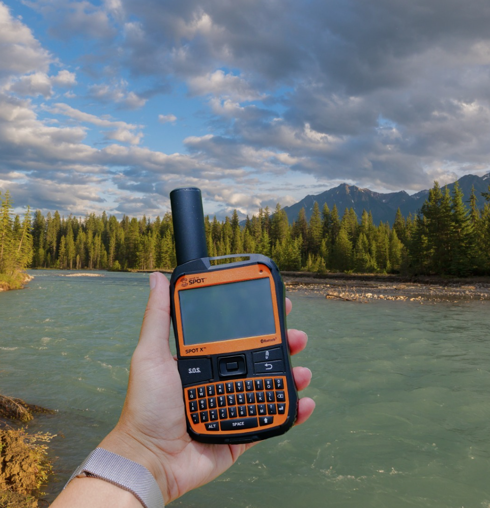
The SPOT X looks reassuringly self-contained. Its QWERTY keyboard is built right into the unit, so a dead phone does not stop you composing a message. In practice, the keys are so small that I ended up typing with my fingernails. With gloves on, I could forget it. The keyboard is backlit, but the directional pad is not, which made menu navigation surprisingly irritating in a dark tent.
I often used the SPOT phone connection just to get away from those tiny buttons. That helped with typing, but pairing took a couple of tries and the app made contact syncing harder than it should have been. Once connected, it was stable enough. It just felt like older software on a device I was carrying for peace of mind.
Garmin's little colour screen sounds less useful on paper than a full keyboard, yet I preferred it for short messages. It was readable outdoors and the physical side buttons gave me another way around the interface when the screen was wet or I was wearing gloves. I could send a text from the unit itself. Photo sending required a paired phone and Garmin Messenger. The device alone cannot do that.
Garmin's software is not perfect either. Messenger handles conversations, while Explore handles the richer maps and routes. I would rather have one app. At least the Bluetooth connection was stable in my use, and I did not find myself repeatedly fighting it at camp.
SOS and confidence in the controls
Both have a protected physical SOS control, which matters more to me than another clever app feature. I never needed a real rescue with either device. I did use Garmin's permitted SOS test, and a reply came back promptly from Garmin Response. It showed that my unit and account could complete a test exchange. It cannot tell me how a real emergency would unfold.
I did not press the SPOT X SOS button or run an SOS test, so there is no honest rescue-response comparison to make here. Its physical button sits under a protective flap and felt secure. What bothered me was the additional SOS option in the on-screen menu. In the dark, with that unlit directional pad, I nearly selected it while trying to read a message. I did not trigger an alert, but I wanted a way to remove that option and rely on the protected button.
For either device, the practical habit is the same: register it, activate the right plan, show your contacts what a normal check-in looks like, and learn how to send a message before heading out. A communicator is less comforting if you first have to discover its menus on a wet trail.
Tracking for someone following your route
Tracking is where the two different trips and settings really matter. The Garmin recorded my route locally and sent regular points to MapShare at a ten-minute interval. In a gorge, an update could be delayed even though the unit continued recording. A person looking at the shared map might briefly see an old point, so I would still agree on a sensible check-in plan with them instead of treating every gap as trouble.
The SPOT X uploaded points reliably on exposed bike rides. Under dense trees, though, points often failed to reach the map and left wide gaps in the visible route. If your family is watching progress in real time, those holes can create the same worry as a late text. The tracking record was most useful when I was somewhere the antenna could see the sky.
With either unit, I kept the antenna upright and outside the pack. If a message queued, I waited or moved into an opening when I could. It also helped to agree in advance what a missed check-in meant, since a gap on the map could simply be a gap in satellite coverage.
Battery, charging and what the numbers mean
Both got through the trips I asked of them, but I used them differently. The Garmin came close to two weeks with ten-minute tracking and a 30-second screen timeout. That impressed me because I was leaving tracking on, not just switching the device on for a couple of check-ins. A power bank and USB-C cable topped it up on longer trips; a full recharge took roughly two hours in my use.
The SPOT X would last for weeks when I left tracking off and sent a few preset check-ins each day. With tracking running, it still made it through long weekends. That is good endurance, but comparing “weeks with tracking off” to the Garmin's “nearly two weeks with tracking on” would be nonsense. I did not run a matched battery test. The one small annoyance is SPOT's Micro-USB port: I now carry more USB-C equipment, so it meant keeping another cable handy.
Carrying them through rain and rough ground
The Garmin is the easier object to live with on a shoulder strap. At a published 125.2 grams, it felt light enough that I stopped thinking about it. Mine took storms and a brief creek drop without complaint. I still kept it exposed rather than buried inside the pack, because a neat packing job is no use if the antenna cannot see the sky.
The SPOT X is a chunkier thing, closer in feel to an old walkie-talkie, with a long antenna that sticks out above the body. Its published weight is 198.4 grams. It survived drizzle, rain and being knocked about during canoe trips with no water ingress I could see. I had to pay more attention to how I mounted it: upright on top of the pack or a shoulder strap worked far better than tucking it away. It is tough; it is simply harder to forget you are carrying it.
Hardware price and the ongoing plan
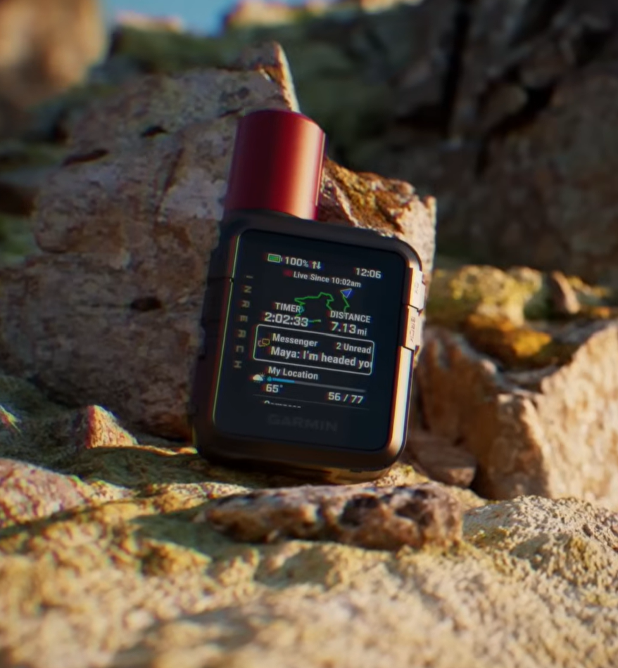
I paid CA$509.99 for the Garmin inReach Mini 3 Plus. I paid €274.00 for the SPOT X during a promotion that also waived a €29.95 activation fee, then used SPOT's Flex Basic plan at €17.95 a month. Those purchases happened in different currencies and markets, and one was an offer. The figures tell you what I spent; they are not a clean price comparison or a current price list.
Both need an active service plan for satellite communication and SOS, and the plan is part of the real cost of ownership. Garmin's tiers vary in their text, tracking, weather, voice and photo allowances. My SPOT plan suited a season of use, though its messaging delays took the shine off the promotional hardware price. Before buying either, I would check the current plan for my country and estimate a year of the features I would actually use, including activation or reactivation fees.
If the only reason you want a device is a distress beacon, our satellite communicator vs PLB guide explains that choice. Both of these units earn their place mainly because they can send normal two-way messages as well as provide SOS access on an active plan.
My verdict
Garmin for wooded routes; SPOT X for open terrain
The SPOT X has a tough case, very good battery life with light use, and the freedom to type without a phone. I can see why an open-country rider or paddler might like it. But for the forested routes and valley camps that made me want a satellite communicator, its delayed messages were too unsettling. The Garmin is the one I would buy again. Its own sky-view limits are real, yet the everyday messages and controls gave me much more confidence.
Read the field tests
Full reviews behind this guide

Sources & context
What I checked
The field observations and prices above come from my two independent reviews. For satellite reception advice, see Garmin's reception guidance and the SPOT X user guide. Both describe the need for a clear view of the sky.
Editorial disclosure: I bought both devices myself. Garmin and SPOT had no involvement in either review or this comparison.