

A GPS watch and a satellite communicator solve different hiking problems. The watch provides maps, route guidance, position, activity data and a navigation tool that stays visible on the wrist. The communicator moves messages and tracking points beyond the hiking party and can start an interactive SOS. Receiving GPS signals does not give a watch the ability to send a message through space.
Evidence behind this comparison
Adam used the COROS Nomad and Garmin inReach Mini 3 Plus during three months of hiking, camping and cycling across Quebec. The watch was assessed for mapping, positioning, endurance and activity recording. The communicator was assessed for messaging, transmitted tracking and remote contact. They were carried in overlapping terrain, but this was not a controlled antenna or battery contest.
Our recommendation
Choose the GPS watch when your main need is navigation and activity recording. Choose the satellite communicator when somebody outside the hike must receive messages, tracking or an SOS. For regular travel beyond mobile coverage, carrying both is the more complete system. If safety is the reason for buying only one device, the communicator addresses the larger gap because a watch without independent satellite communication cannot summon outside help on its own.
Two devices with different jobs
A GPS watch listens to navigation satellites and calculates where it is. It can plot that position on an offline map, compare it with a loaded route and record speed, distance and elevation. Those functions continue without mobile reception because receiving positioning signals does not require a data connection.
A satellite communicator also calculates its position, but it adds a communications radio and paid service. It can transmit a message or tracking point through a network such as Iridium, then receive a reply. That outgoing link is the important difference.
The shared word satellite creates confusion. GPS, Galileo and similar systems broadcast timing signals that compatible devices receive. A watch using those signals is not automatically capable of transmitting to emergency services. The Nomad's safety alert, for example, requires a Bluetooth connection to a phone with cellular service. It is not an inReach built into a watch.
GPS watch vs satellite communicator at a glance
| Measure | GPS adventure watch | Satellite communicator |
|---|---|---|
| Primary job | Navigation, activity recording and wrist-based outdoor data | Off-grid messaging, transmitted tracking and interactive SOS |
| Our example | COROS Nomad, rated 4.5 / 5 | Garmin inReach Mini 3 Plus, rated 4.9 / 5 |
| Offline maps | Detailed topographic and landscape maps on the wrist | Basic map and course line on the Mini 3 Plus |
| Route guidance | Strong, with off-course alerts and Back to Start | Useful backup rather than a detailed planning tool |
| Messages beyond mobile coverage | No, unless the watch includes a separate satellite service | Yes, with an active plan and satellite access |
| SOS | Nomad alerts depend on a connected phone and mobile service | Interactive satellite SOS through Garmin Response |
| Tracking | Records a detailed activity locally | Can transmit progress to people elsewhere |
| Measured endurance | 20 to 22 days daily use; about 50 hours All Systems GPS | Close to two weeks with low-power messaging and 10-minute tracking |
| Ongoing fee | No subscription required for Nomad maps and activity features | Active satellite service plan required |
| Carry position | On the wrist | High and exposed on a shoulder strap |
Navigation and route finding
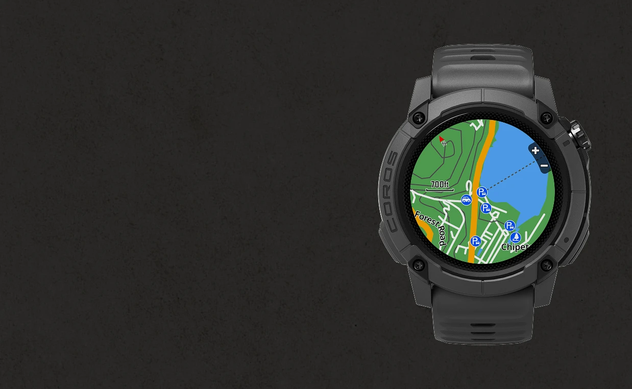
The watch is the stronger navigation tool. The Nomad stores global offline topographic and landscape maps, shows trails, roads and points of interest, and keeps the route line available at a glance. GPX routes imported through the COROS app reached the watch quickly during our test. The digital crown made map zooming predictable in rain and gloves.
Off-course alerts warn when the wearer leaves the planned line, while Back to Start can retrace the recorded path. The watch does not calculate a new route around an obstacle, so a washed-out bridge still requires judgement and a map-based decision. Its small screen also favours quick orientation over broad route planning.
The Garmin has a colour basemap, saved courses, waypoints and TracBack. These are useful when the phone is unavailable, but the screen and map detail are better suited to checking direction than planning through complex terrain. Garmin Explore provides richer maps on the paired phone, which makes the system more capable while adding another battery and interface.
Positioning accuracy and recorded tracks
The Nomad acquired position in less than five seconds during routine use and produced dependable tracks beneath wet Laurentian forest. Alongside a Garmin Edge 540, recorded distance and elevation were close enough that neither changed our interpretation of the ride. All Systems mode provided the best everyday balance; dual-frequency mode remained available for difficult reception.
The inReach recorded a local activity and transmitted 10-minute tracking points to MapShare. Its multi-band position stayed close to the route, though a deep gorge could delay transmission even while local recording continued. That distinction matters: calculating a position and delivering that position to somebody elsewhere are separate operations.
For analysing pace, elevation, heart rate and the exact line taken, the watch produces the richer record. For letting family see progress from home, the communicator provides the relevant connection.
Local recording and remote tracking
Watch manufacturers often call activity recording tracking. Satellite-communicator companies use the same word for sending periodic positions to a remote page. The two functions should not be treated as equivalent.
The Nomad stores the activity on the watch and syncs it to the COROS app later. Friends do not automatically receive those points from a mountain with no mobile service. Its safety alert and live-tracking link need the paired phone to retain cellular connectivity.
The Garmin can send tracking points through Iridium. During our trip, MapShare gave people at home a private link to follow progress. A gorge might delay a point, but the system could forward it after regaining useful sky. This remote visibility is valuable for an overdue procedure, although a dot on a map is not proof that the person carrying it is safe.
Messages and changing plans
The GPS watch can show phone notifications while it remains connected, but it does not create service where the phone has none. Once the mobile network disappears, the Nomad remains an effective map and recorder while ordinary messages stop.
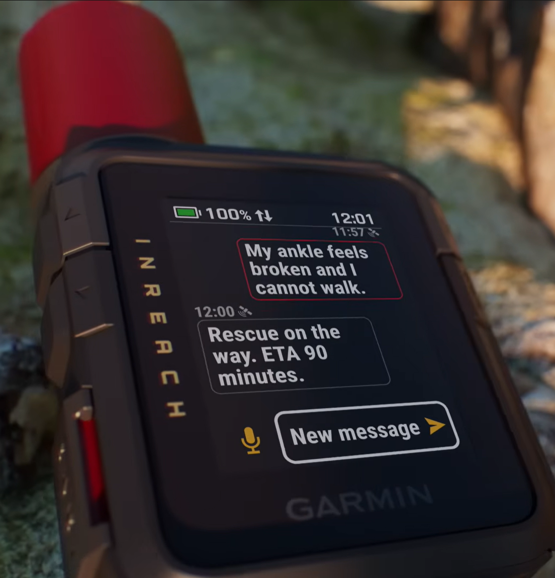
The communicator is built for that moment. Open-sky texts from the Mini 3 Plus normally sent in under 30 seconds during our test. Heavy forest extended routine waits to around three to five minutes. The device could compose short text and voice messages without a phone, while Garmin Messenger made longer conversations easier.
This capability helps before an emergency. A delayed walker can update a pickup time. A group can report a changed campsite. Family can confirm that a message arrived. Preventing an unnecessary alarm is part of the communicator's value, not an incidental feature.
SOS and the route to outside help
The Nomad does not independently contact emergency services. Its safety alert can share a location and live-tracking link through the COROS app, but the watch must stay connected to a phone with cellular service. That can be useful near coverage and irrelevant in the exact place a remote walker needs another route out.
The Garmin's protected SOS control starts an interactive conversation with Garmin Response through the satellite network, provided the subscription is active and the device has charge and useful sky. The user can explain injuries, party size, shelter and changing conditions. The response centre can acknowledge the alert and coordinate with appropriate services.
We used Garmin's permitted SOS test rather than initiating a rescue. No consumer device guarantees how quickly help will arrive. Terrain, weather, jurisdiction and available responders still govern the outcome.
Battery life and power planning
The Nomad lasted 20 to 22 days in normal watch use. All Systems GPS consumed roughly 2% per hour, supporting about 50 hours of continuous recording. Dual-frequency use projected closer to 32 to 34 hours. Long daily use, backlight time, navigation and connected sensors all change the result.
The Mini 3 Plus approached two weeks with low-power messaging, 10-minute transmitted tracking and a short screen timeout. Garmin's higher-performance messaging mode, poor sky, cold and frequent screen use can reduce that substantially. Both devices recharged in under two hours during our tests.
The numbers are not directly comparable because the radios perform different work. A watch recording locally uses power differently from a communicator repeatedly checking and transmitting through a satellite network. A long trip needs reserves for both rather than choosing whichever marketing figure looks larger.
Carry, access and weather
A watch stays attached and visible. The Nomad's 47 mm case was comfortable enough for continuous wear, though it caught tight jacket cuffs and winter gloves. Rain, mud and lake submersion caused no functional problem during three months, and the physical crown remained useful when touch control became awkward.
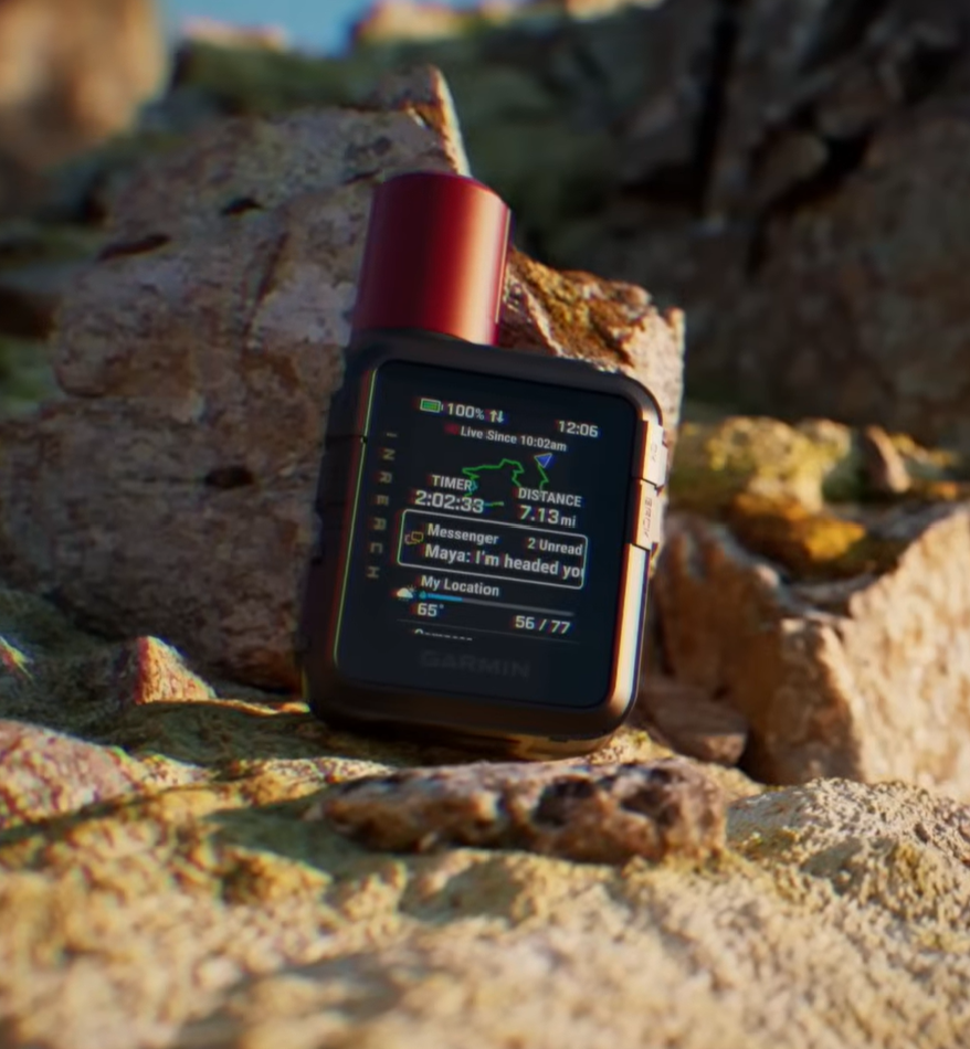
The 125.2 g Garmin disappeared on a shoulder strap but needed deliberate placement. Its antenna worked best upright with open sky, not buried in a pocket or pack. Physical side buttons retained full control in heavy rain and gloves. It survived storms and a brief creek drop during the test.
Accessibility is part of safety. A communicator carried at the bottom of a pack may be unreachable after a fall. A watch is already on the body, but its location does not compensate for the absence of an off-grid communications radio.
Cost and subscriptions
We paid US$349 including VAT for the COROS Nomad. Its offline maps, activity recording, route tools and COROS app did not require a premium subscription. The watch also provides daily value through sleep, recovery and training data, so its cost covers much more than the occasional remote hike.
We paid CA$509.99 for the Garmin inReach Mini 3 Plus. Satellite messaging, tracking and SOS require an active service plan. Prices and included allowances change, so compare the current activation fee, recurring cost, message allowance and tracking charges in the account's country.
The watch offers more functions per pound or dollar. The communicator buys a capability the watch does not possess. Cost comparisons only become useful after deciding whether the trip needs navigation data, outside communication or both.
Choosing for common hiking situations
Marked day walks with reliable mobile coverage
Choose the GPS watch. It keeps the route visible, records the activity and avoids pulling out a phone at every junction. A charged phone and sensible route plan cover ordinary communication.
Solo hiking beyond mobile coverage
Choose the satellite communicator if buying only one device for safety. It provides check-ins, outside contact and interactive SOS. The watch remains valuable for navigation, but it does not close the communication gap.
Multi-day hiking with a planned route
Carry both. The watch handles detailed route guidance and records the day. The communicator sends scheduled check-ins, transmitted tracking and messages about delays or changed campsites.
A group that may separate
Every independent subgroup needs a communication plan. One inReach carried by the fastest walker does not help the people who fall behind. Watches on every wrist still do not provide outside contact.
Training-focused trail running near civilisation
Choose the watch. Pace, heart rate, route guidance, recovery and compact wrist access matter more than dedicated satellite messaging when the route remains close to assistance and mobile coverage.
Using a GPS watch and communicator together
The most effective setup assigns each device a clear role. Load and check the route on the watch. Put the communicator high on a shoulder strap, start transmitted tracking when appropriate and send the agreed check-in. Keep detailed mapping available on the phone or paper as another layer.
Agree with the home contact what missed points and messages mean. A delayed tracking upload can result from poor sky rather than an accident. A point that continues moving does not confirm the hiker's condition. Scheduled plain-language check-ins provide better context than passive dots alone.
Plan charging as one system. The watch, communicator and phone may share a power bank but use different adapters or cables. Keep enough reserve for the communicator to remain useful at the end of the trip, when fatigue and changing weather can increase risk.
The buying decision
Buy the GPS watch for maps on the wrist, route alerts, activity recording and multi-week everyday use. It helps answer where you are, where the planned route goes and how the hike is progressing.
Buy the satellite communicator for messages beyond mobile coverage, tracking visible to people elsewhere and a managed two-way SOS. It helps answer whether anybody outside the hike knows what is happening.
For regular remote hiking, these are complementary devices rather than substitutes. If the budget allows only one, start with the problem that has no other adequate solution. A phone with offline maps can cover much of the watch's hiking role. A normal phone cannot create satellite service where none exists.
Read the field tests
Full reviews behind this guide
Related guidance
Communication choices beyond the watch
Our satellite communicator vs PLB guide compares interactive messaging with a dedicated 406 MHz distress beacon. Our satellite vs mesh guide explains outside contact and local group communication.

Editorial disclosure: Adam bought the COROS Nomad and Garmin inReach Mini 3 Plus with his own money. Neither manufacturer had any involvement in the reviews or this comparison.